EUSpace4Ukraine
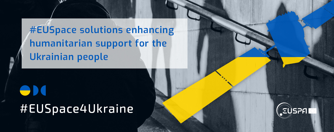
EUSPA is mobilizing the EU Space innovation community that can provide technological solutions to enhance humanitarian support for the Ukrainian people. This platform aims to match the innovators with NGOs and other helpers through #EUSpace4Ukraine Network.
#EUSpace4Ukraine Network
The network brings together space innovators and application developers with NGOs and helpers.
Want to be part of our network? Email us!

Applications and solutions that leverage freely accessible data by Galileo and Copernicus to support NGOs and other helpers.

NGOs and other helpers are providing humanitarian support to the Ukrainian people.

Providers offer geospatial data relevant for both application developers and NGOs.
The Applications are listed on the basis of elements known to EUSPA1 and a subjective evaluation of the known characteristics of the applications.
Categories:
- Unmanned solution for transport and delivery of goods
- Safety and Rescue
- Integration in a new country
- Applications to help understand and inventory the impact of war in Ukraine
- Safe, timely and accurate Navigation for Population migration
The Apps: Unmanned solution for transport and delivery of goods.
NAUTILUS
Country: Italy
NAUTILUS is a drone solution by ABZero with a unique navigation GALILEO system for the delivery of medical goods. The Smart Capsule by delivering blood, organs, tissues, test samples, drugs, and tampon swabs that enables everyone using drones, can help overcome many challenges in the transportation of pharmaceutical goods in Ukrainian territories.
Learn more here.

Dronmed
Country: Romania
Collecting and transporting medical samples from hard-to-reach areas is done with high transport costs, especially in areas where there is not much medical activity, such as family medicine practices that are some distance from a collection center. At the same time, for the collecting laboratory, there must be a return on: the number of samples and the distance traveled. Considering the above, DronMed comes to fill this niche and to address especially the isolated areas at a distance of more than 100 km from a collection center.
Learn more here.

Wingcopter
Country: Germany
Wingcopter is a German manufacturer of unmanned drones dedicated to saving and improving lives of people. The company focuses on the delivery of medical goods, parcels, and food and Wingcopter UAVs can leapfrog difficult terrain and poor infrastructure, while maintaining a temperature monitored cold chain. Due to its ability to take off and land vertically, the Wingcopter can land in confined spaces. With its unique, patented tilt-rotor mechanism, the drone by far exceed the range and payload capabilities of commercial multicopter drones, achieving a new dimension of efficiency.
Learn more here.

SAFE, FAST AND AUTONOMOUS
Country: Portugal
Connect Robotics offers drone automation services for urban and hard to reach destinations, plus transport systems using drones. Currently it is focused on the health area, mainly in the transport of medicines and blood, which presents greater challenges and where the need is greater. To this end, it has been working in recent months to develop solutions that meet the transport requirements of medicines and biological substances. The aim is to offer a flexible, safe and reliable solution that incorporates the delivery and handling processes of pharmacies, hospitals and analysis clinics, in a transparent and automatic way. On demand and fast transportation where it matters.
Learn more here.

Thunderfly
Country: Czech Republic
ThunderFly is a company specializing in the development and production of unmanned aerial vehicles and systems for performing atmospheric measurements. Their flagship UAV is a modifiable open-source autogyro carrier designed to operate in unfavourable weather conditions. Together with TF-ATMON, a system for smart and easy in-situ atmospheric measurements, this can prove especially useful for researchers and rescue teams. The variety of quantities that can be measured is really diverse from solid particles and radiation to gases or temperature. Using TF-ATMON quantities can be easily measured in a user-defined space and possible sources of pollution can be localized.
Learn more here.

The Apps: Safety and Rescue.
DroneHub
Country: Poland
Dronehub makes steps towards autonomous drone operations and industrial automation. It was specifically developed for remote missions where the drone can be deployed on-demand or available day and night to run in a continuous operation. Entirely automating drones' services, it would improve speed and safety of drones operations in emergency zones of Ukraine.
Learn more here.

Heymedica
Country: Romania
Heymedica is a platform that unites all providers of medical services, hospitals, clinics, analysis laboratories, pharmacies, dentists, specialists and family doctors and connects them with all patients in Europe in one place. "One Health, One Europe, One Platform". Any Ukrainian medical provider hospitals, clinics, analysis laboratories, pharmacies, dentists, specialists and family doctors can sign up for free and use the full version and the scheduling system in the unlimited version, and any Ukrainian citizen can monitor their cardiovascular risk lifestyle and use a medication reminder. Everything is free and unlimited for Ukraina!
Learn more here.

RECTANGLE
Country: Poland
RECTANGLE provides Hi-end Guidance, Navigation and Control solutions for handling all tasks related to unmanned systems operations. The solution consist of a portable ruggedized Ground Control Station (GCS) hardware platform capable to be used in difficult terrain & weather conditions, dedicated software enabling mission planning & UAV/UGV/USV fleet management as well as on-board computer & autopilot software - the control solutions for unmanned platforms. The completeness of the solution is complemented by a Galileo-based navigation system, providing precise and reliable information about the unmanned system positioning.
Learn more here.
Smart Alert
Country: Greece
Smart Alert is an app that lets you notify nearby people with a touch of a button so you receive help immediately. The app prioritizes first responders and provides guided first aid till the ambulance arrives. According to a Red Cross survey, if first aid is applied before emergency services arrive, 59% of deaths would have been preventable and healthcare costs of 64b €/ year can be saved in the EU. Each year many people face emergencies and don't receive a proper response from society. As a result, a high percentage doesn't survive while some of them continue their life with disabilities. When an emergency happens people can call 112, their family or friends usually need a lot of time to reach us. It is not possible notify those who are located nearby and are able to help. Minutes are crucial. Disabilities are also an important issue in terms of healthcare costs. Smart Alert can mitigate these problems and provide solutions that can save lives.
Learn more here.
AeroVR
Country: Spain
AeroVR is an innovative solution that combines virtual reality technology with Unmanned Aircraft Systems (UAS) operations. Their solution consists of a virtual Ground Control Station (GCS), where operators can control a real UAS remotely, using Virtual Reality (VR) glasses and a 4G connection. The operator can clearly see telemetry data and a representation of the UAS moving on a 3D map, making it easy to observe its route.
Conventional radio control stations need to be close to the UAS to have a direct radio link, which exposes the operator and the GCS to the multiple risks that could turn out losing communications and putting the operation and the operator safety in danger. To mitigate these problems AeroVR enables the controller to operate from anywhere, utilizes Copernicus data for emergency situations and employs Galileo technology to navigate precisely to the location of the emergency. The 3D environment shows the exact location, telemetry, and data of the real UAS, providing a comprehensive view of the operation, making easier and more convenient to operate UAS, especially in risky humanitarian situations.
Learn more here.

TheSaraProject
Country: Italy
The original necessity for SARA product comes from issues related to Search and Rescue (SAR) operations encountered by personnel of Coast Guard during their save and rescue missions. Sara products represent an effective solution to track and identify people in save and rescue activities, actually crucial in Ukraine.
Learn more here.

The Apps: Integration in a new country.
ZeniaLabs
Country: Spain
Hardware and Embedded software systems powered with Artificial Intelligence, to automate any kind of equipment, including mobile and manipulation robotics, drones, connected vehicles and telecommunication systems. The aim is to lead integration of devices and systems and crisis management.
Learn more here.

Integreat
Country: Germany
Integreat enables the simple flow of information between municipalities, aid organisations and refugees. Content is created locally by municipal and NGO employees, translated and pushed out via the Integreat smartphone apps for iOS and Android and the website in every municipality. Municipalities and NGOs receive their individual region on the Integreat platform and create their own Integreat app within days or weeks supported by the Integreat project team. The team has been the 2nd place winner in EUSpace4Ukraine Hackaton held from 29th June to 1st July.
Learn more here.
StandwithUkraine
Country: Romania
Disruptive, Innovative IT company with a broad portfolio of business, financial & community focused applications using latest technologies, geo-location, distributed processing and advanced analytics. Expertware has a team of 50+ computer science engineers based in Romania, capable to translate real needs to efficient, tangible, modern solutions and applications deliverable across Europe. They leverage and combine their core competences in full stack development, business intelligence and data analytics, cybersecurity and IT transformation.
Learn more here.
CommuApp
Country: Finland
Commu is a free mobile app where you can request and give help in your local area. Commu was originally built to make it easier to help your neighbors during the Covid period. Commu connects the helper and the person in need of help as easy as possible. This includes volunteer help, neighborhood help, peer support, chatting and so on. The intention is to make it easier to help and ask for help and most importantly, to use active helping as way to connect in a meaningful way.
Learn more here.

The Apps: Applications to help understand and inventory the impact of war in Ukraine
EmergencyWatch
Country: France
EmergencyWatch uses satellites imagery and AI to provide updated information on a wide range of situations, which reinforces context analyses and allows NGOs to adapt their support to the population. For example, they monitor, according to the crisis: level of destruction, agricultural work continuity, dryness situation, refugee camps emergence, generated pollution in water and atmosphere.
Learn more here.

EarthDaily Agro
Country: France
A leader in Earth Observation, EarthDaily Agro is harnessing the power of Earth Observation to empower companies, government and individuals to address the world’s most challenging problems. Front and center are the direct and indirect impacts of war in one of the most important crop production regions of the world. War in Ukraine has disrupted the short-term food supply and for years to come across the globe. EarthDaily has initiated several efforts to deliver the data the world needs to predict and midigate the impacts for today and for the long term.
Learn more here.
Together!
Country: Poland
Together! Is a new web application that should be visited by anyone who wants to help Ukrainian citizens in the wake of the armed assault on their country. Through the app, it is possible to interlink those in need with people who want to help them. Without unnecessary formalities, Refugees coming to Poland can report their needs in such categories as accomodation, transportation, food, health or legal assistance, among others, and the foundation’s volunteers will help meet these needs. The application is free and available to everyone. Precise localization of person in need and volunteer is provided by Galileo navigation system. It works in Ukrainian, Russian, English and Polish. Full access to the app is gained after a brief Verification by a Foundation volunteer over the phone. Together! Is constantly improved, the solution is now being expanded for new functionalities under European Space Agency project.
Learn more here.
Cloudferro
Country: Poland
The CloudFerro provides processing capabilities to support Ukrainian and international authorities in assessing the environmental impact and damages induced by the war in Ukraine. The data repository will consist of core data sets which will be available to end-users to allow for versatile environmental analyses. Results of conducted research together with generated products will be also stored within the repository to further facilitate the consecutive studies. The granting system is foreseen for computing grants with special privileges for Ukrainian researchers.
Learn more here.

Vista's YPSilon
Country: Germany
Vista Geowissenschaftliche Fernerkundung GmbH, founded in 1995, has been working with optical and radar remote sensing data for over 25 years, making it available to clients and customers in over 25 countries worldwide. Vista solutions, especially in the field of smart farming and yield forecasts, have been established on the market for years. Vista’s YPSilon (Yield Prediction by Satellite) service continuously monitors the growth of cereals, corn and oilseeds from space and forecasts the expected crop yield across Europe. Satellite information is combined with Vista's own models for radiation transfer and plant growth. More than 200 parameters are taken into account, to accurately track and predict biomass growth and plant development. The YPSilon yield forecast on various crop types in Ukraine has been provided to the Ukrainian government in order to provide unbiased data and to enable efficient allocation of resources.
Learn more here.
KERMAP
Country: France
KERMAP is an innovative company specialized in the production of geospatial data and territory monitoring through satellite imagery. KERMAP has developed a solution called Nimbo (nimbo.earth), which allows for the identification of crops in most European countries, including Ukraine (see the demonstrator for 2020 here: https://agri.nimbo.earth/). By using Sentinel-2 and Sentinel-1 satellites and proprietary artificial intelligence models, KERMAP can provide indicators on agricultural production areas in Ukraine and the impact of the war on them through dashboards or visualization platforms.
Learn more here.
Airbus
Country: France | Germany
Airbus Intelligence is a global leading provider of commercial optical and radar satellite imagery and geospatial services and solutions with over 30 years of experience in the Earth Observation field. Decision makers and analysts are supported in over 100 countries and across multiple industries, be it commercial, institutional or defence, who require a precise and remote view of our changing planet. Their imagery and data is as diverse as the needs of their customers - whether they are looking for wide coverage, fine detail, intensive monitoring, premium reactivity, timely image acquisition or extensive archives - the right solution and combination of products. Their evolutionary technologies and high quality data enables their customers to gain information as well as decision superiority at the speed of relevance and across all domains. In the context of the war in Ukraine, Airbus Intelligence is leveraging its data collection and processing capabilities to help assess the damages on the ground in order support the future reconstruction effort.
Learn more here.
Web2Learn
Country: Greece, Norway, Germany/North-Macedonia
Cultural heritage under threat provides solutions that includes the identification and mapping of the damages of war on cultural heritage sites. Based on the inclusive engagement by citizens that collect in-situ observations of cultural heritage sites, nationwide networks of sensors collecting air quality data, all in combinations with Copernicus change detection, Galileo/EGNOS data applied on various impact scenarios, an overview and information relevant for cultural heritage management is created. The team has been the 3rd place winner in EUSpace4Ukraine Hackaton held from 29th June to 1st July.
Skytek Satellite Club
Country: Country: Ireland, Romania, Poland, U.K.
Skytek's Satellite Club was created to provide loss damage assessment using Earth Observation imagery. Club members have access to real-time information from satellite images using Skytek’s proprietary technology, combined with expert analysis and reporting. Since the beginning of the war in Ukraine Skytek has been monitoring and reporting on the destruction of assets on the ground. Skytek has also been monitoring vessels, their condition, and their activities in Ukrainian ports.
Learn more here.
SERCO
Country: Italy
ONDA DIAS bridges the exhaustiveness of the EC sentinels products with cloud based elements to ease the access and exploitation of the data. In the framework of Emergency management, the platform provides the tools to generate cartographic products, contributing to maintain humanitarian stakeholders informed about the situation on the ground. Coupled with Copernicus satellite data, ONDA DIAS enriches its offer with VHR data. All these data allow ONDA users to generate large-scale products for an overview vision, in particular on IDP camps extension, or, precise-scale cartographic products for a contextual analysis with additional information (IDP Camp structure with medical center, drinking water stand pipe…). To ease the adoption of cloud based EO platforms, SERCO developed specific training (ONDA4Education) and trial periods. Such programs are available to Humanitarian actors to reduce the technical barriers. increase the confidence with this technology and secure the production of Value added information adapted to the relief’s operational chains.
Learn more here.
LiveEO
Country: Germany
LiveEO uses satellite technology to monitor large infrastructure networks globally. Within the framework of the initiative, they provide analytics based on satellite data to support NGOs and other humanitarian actors in detecting the location and assessing the extent of damages to infrastructure induced by the war in Ukraine.
Learn more here.

Super Resolution for Climate Crisis Context
Country: Austria
The goal is to provide data-driven insights and critical information about the scope and severity of environmental damage in conflicts in order to better understand conflict-driven environmental damage. This project will use geospatial analysis through earth observation (EO) to inform post-war/conflict assessments and environmental impacts that can translate into decision-making, humanitarian response and reconstruction efforts needed for environmental damage control.
Learn more here.
Digifarm
Country: Norway
The app developed the highest accuracy model for automatically detecting field boundaries and seeded acres in-season (current growth season) based on a super-resolution model of Sentinel-2 at 1m per pixel. Subsequently, the ability to detect seeded acres for the Ukrainian agricultural season of 2022 is critical for assessing global food supply and production. Additionally, accurate field boundaries and seeded acres is the fundamental and required layer of Crop classification and yield-forecast.
Learn more here.
World from Space
Country: Czech Republic
World from Space is a Czech company bringing the benefits of space technology to sustainable society. Their key technology domains are Earth Observation and geospatial and big data analysis, especially in the urban, environmental, and agricultural domains. They focus on advanced data analysis and machine learning by means of satellite imagery and data from the Copernicus services. The company’s flagship product DynaCrop API provides global crop monitoring for agriculture software. The main information of this API originates from the European Sentinel satellites of the Copernicus Programme. In 2023, World from Space, in collaboration with NGO Arnika, has published a study about air pollution in Ukraine, based on the Copernicus Sentinel 5p satellite imagery.
Learn more here.

European Space Imaging
Country: Germany
Supplier to the remote sensing industry, currently offering the highest spatial resolution imagery currently commercially available to customers in Europe, North Africa and CIS countries. They provide access to the archive Imagery and to the new collections that could be an imminent help for damage assessment and reconstruction measures.
Learn more here.

The Apps: Safe, timely and accurate Navigation for Population migration.
GINASystem
Country: Czech Republic
GINA Software is a provider of safety and security management system called GINA. It combines vehicle and personal tracking, mapping, security reporting and analysis, task management with situational awareness tools. Thanks to strong focus on humanitarian operations in hostile environment it is an ideal tool to improve staff security.
Learn more here.

Nemi
Country: Spain
Nemi fosters public transport in low-density areas by providing a software solution that enables flexible bus services. Totally flexible and adaptable to all types of operating models, designed to incorporate public administration's requirements and intended for local administrations, transport authorities and public transport operators. Special importance in managing refugees' transport operations.
Learn more here.

Epic Blue
Country: Belgium
Epic Blue is a software company specialized in seamless indoor & outdoor positioning of people. The solutions guarantee the blue dot on the map, even in the most challenging environments. With Shyn, a high-end AI-driven wearable has been developed packed with sensors for the ultimate positioning support. Guardian is the most advanced Worker-At-Risk application for indoor localization, (automatic) alerting and critical communication.
Learn more here.
LAIA
Country: Spain
LAIA is the winner project of the EUSpace4Ukraine hackathon (organized by EUSPA and Ultrahack) with a solutions that use Copernicus data to solve major challenges faced by mobility and transport systems in war or conflict areas, like Ukraine. The joint desire to help the participants is well illustrated by the fact that the winning solution was born from two competing ideas: the first team tried to identify dangerous areas from image, multi spectral camera and SAR radar data collected by the Sentinel satellites of the Copernicus system, for example based on smoke and heat observations; the other team tried to find safe routes to transport food and other supplies to those in need. The team has been the 1st place winner in EUSpace4Ukraine Hackaton held from 29th June to 1st July.
Global Smart Rescue
Country: France
The value of Global Smart Rescue (Little Alert Box) (hardware and software) in Ukraine for environmental monitoring, IoT satellite, and crisis management using smart terminals lies in its ability to provide real-time data on environmental parameters (such as air quality, temperature, humidity, and noise levels), enable effective communication during crisis situations, and improve overall preparedness for emergencies. These capabilities can contribute to the protection of the environment, the safety of people, and the efficient management of crisis situations.
Learn more here.
WaveOut
Country: Austria
WaveOut is an audio augmented reality navigation app where people can go anywhere simply by listening. Anyone can go anywhere without looking at the screen. Just listen and follow a 3D sound until the destination. With a regular app, you only need to look at the map and understand where to walk on the street or listen to turn-by-turn instructions which can be confusing. With waveOut, virtual waypoints are at real locations, outdoors. With headphones, you can hear and follow the sound waypoints just like if a friend calls from across the street.
Learn more here.

1. EUSPA disclaims any responsibility concerning the completeness of the list, possible omissions, the actual fitness for use of the listed applications, the possible breach of third parties’ rights arising from the use of the listed applications.
The NGOs are listed on the basis of elements known to EUSPA1 and a subjective evaluation of the known characteristics of the applications.
Categories:
NGOs
Cruz Roja
Country: Spain
Spanish Red Cross has not stopped working in the almost eight years of conflict in the Donbas region of Ukraine. With the conflict escalating, our priority is to serve the civilian population affected by the conflict in Ukraine and the displaced people who have been forced to leave their homes and cross borders with other countries. Red Cross across Europe is turning to care for the more than 18 million people in need of humanitarian assistance. Spanish Red Cross supports the humanitarian services of the Red Cross in Ukraine and neighboring countries and welcomes people who arrive in Spain from Ukraine.
Learn more here.
People In Need
Country: Czech Republic
PeopleInneed is working in Ukraine, delivering emergency assistance to the war affected areas – mainly food, water, hygiene kits. PeopleInnnedd assists people displaced within Ukraine through equipping refugee centers, as well through cash assistance to vulnerable people, assisting refugees with material, legal and psychosocial aid, as well as with the integration to education, housing and labour market. In addition, in Czech Republic PeopleInneed is assisting refugees with material, legal and psychosocial aid, as well as with the integration to education, housing and labour market.
Learn more here.
Helpcode
Country: Italy
Helpcode works on these areas of intervention: education, water and sanitation, emergencies, nutrition and agriculture, gender equality and child protection. In particular, Helpcode supports education and training for children with innovative, practical solutions that improve their physical and mental wellbeing. They work all over the world, in emergency situations and on an everyday basis.
Learn more here.
Blue Shield International
Country: Netherlands
Blue Shield International has worked in consultation with the Government of Ukraine and civil society organisations since the beginning of the conflict, and starting in early November 2022 has conducted a series of on-site assessment missions - in close coordination with the Ukrainian Territorial Defence Forces - assessing not only the impacts to cultural heritage, but identifying cross sectoral capabilities or shortfalls to effectively implement the 1954 Hague Convention for the Protection of Cultural Property in the Event of Armed Conflict, and other relevant instruments of international humanitarian law including security implications of the impacts to the system of cultural resource management. Our assessments have been conducted with the support of imagery analysis with key partners, and documentary data/evidence collected by law enforcement authorities, and CSOs. BSI is supporting the Ukrainian authorities with the provision of technical advice on national policies for the protection of cultural property and development of national capacities in first aid, recovery and risk reduction for cultural heritage, in particular enabling and supporting cross-governmental and cross-sectoral integration; and transversal analysis and enforcement of cultural normative framework and judicial instruments, including alignment with international standards (including for protection of cultural heritage in urban settings, and enhanced protection under 1954 Hague Convention Second Protocol).
Learn more here.

GSCF
Country: France
The association of the French Disaster Relief Group – GSCF, created in 1999, brings together firefighters spread over the French territory. GSCF intervene on rescue missions during earthquakes, floods, etc., but also on humanitarian and development operations. Faced with the nightmare that Ukrainians are experiencing, the humanitarian firefighters of the association of the French Disaster Relief Group – GSCF, created in 1999, mobilized urgently. Millions of people, including women and children, are forced to leave their countries, leaving everything behind in an attempt to flee the violence of the bombing.
Learn more here.
United for U (U4U)
Country: Switzerland
United for U (U4U) is an International humanitarian NGO, offering help to people in emergencies. Registered as a non-profit association in Switzerland, with a branch in France and activities in many European countries, their current focus is the humanitarian crisis in Ukraine but their mandate is broad. U4U has been on the Ground from Day One, finding emergency accommodation to arriving refugees, responding to critical needs for food, medical, mental and administrative support, as well as creating essential cultural and linguistic links between refugees and the host society.
Learn more here.
ReStart Ukraine
Country: Ukraine
ReStart Ukraine is a multidisciplinary NGO developing a vision for complex, future-oriented, and practical recovery of cities and municipalities in Ukraine. The main objective is to assess Ukraine on a national level in various dimensions, including electricity supply, transit routes, environment, and infrastructure, to establish a solid foundation for rebuilding cities and towns after the war. As part of their efforts, the organization is developing a partnership toolbox to address a range of problems, such as infrastructure damage assessment, assessment of debris and their composition, predictive forecasting with respect to changes in the climate, spatial analysis for urban planning, urban planning, and transportation system planning.
Learn more here.
Red Cross Ukranian
Country: Ukraine
Ukrainian Red Cross is the largest Ukrainian humanitarian organization. Main activities are assistance to victims of emergencies, assistance to internally displaced persons, search services, first aid, among others. In particular, since the start of the full-scale war, the Ukrainian Red Cross sent to the regions of Ukraine over 5,418 tonnes of humanitarian cargo. Every day the staff and volunteers in logistical centres receive, sort, assemble, and send to the regions hundreds of tonnes of cargo containing food, hygienic products, medicines, water, bed linen and other essentials.
Learn more here.
Arnika
Country: Czech Republic
Arnika is a Czech NGO officially registered as a civic association. They base their activities on three pillars (engaging the public, professional arguments, and communication), becoming one of the most important environmental organizations in the Czech Republic. Arnika focuses on nature conservation, toxics and waste, access to information, and public participation in decision-making. In 2023, Arnika, in collaboration with World from Space, has published a study about air pollution in Ukraine, based on the Copernicus Sentinel 5p satellite imagery.
Learn more here.

Enlightening Initiative
Country: Ukraine
Enlightening Initiative is a Non-Government Youth NGO created with the aim of empowering youth ukrainian with ICT tools, Artificial Intelligence and business plans to improve any gender employability and promote the socio-economic ecosystem. Over the past months, Enlightening has been working on the development of ChatBot to assist the charitable organization in logistic deliveries; providing humanitarian support in kind of materials and medicine; fundraising with American Universities, and creating a partnership with a consolidated international no-profit humanitarian organization to scale our impact for displaced people in need. Currently, we are developing a metaverse physiological tool with European researchers for assisting children and their mothers that suffer from post-traumatic disorder, awarded by Cruciable Initiative which is sponsored by European Federation of Academies of Sciences and Humanities.
Learn more here.
Helpers
Techukraine
Country: Ukraine
TechUkraine is a new platform focused on supporting Ukraine’s fast-growing tech ecosystem. It will be driving the cooperation of ecosystem leaders, government officials, business partners and donors to further support Tech and to spread the word. TechUkraine’s program will focus on sharing knowledge about the startup ecosystem, creating new platforms in the ecosystem and connecting Ukrainian top startups with global cities, international investors and programs by numerous platform. Their key objective is to unite stakeholders, attract resources, knowledge and skills and jointly create the biggest Tech Hub in Eastern Europe. Techukraine supports Ukraine Chapter on the portal TechUkraine.org, a platform to connect and empower the Ukrainian Tech Ecosystem and scale it globally.
Learn more here.

Giselle Villegas Bourgoing
Country: Italy
ius.cosmos is an educational platform that looks to help students and professionals around the world, especially in underdeveloped countries, learn about space law and the peaceful uses of outer space. We are looking to educate about how can outer space technology help the current Ukrainian situation. They higlight the importance of outer space exploration for the development of space strategies worldwide to assist the situation in Ukraine.
Learn more here.

AVSI
Country: Italy
AVSI implements development and humanitarian aid projects in 38 countries, including Italy. Their vision is to work for a world where the person is the protagonist of his or her own integral development and that of his or her community, even in crisis and emergency contexts. Digitalization is a crucial component in most oftheir projects, in terms of monitoring and implementing actions.
Learn more here.

ITF Enhancing Human Security
Country: Slovenia
ITF has been present in Ukraine since 2014, tackling areas of victims assistance, psychosocial and medical rehabilitation and capacity building. At this moment, ITF is preparing the project “Food assistance for persons, refugees and families in Ukraine” which are greatly impacted by the ongoing hostilities in the country. In terms of the current assistance for Ukraine due to the ongoing armed conflict, ITF is planning the following activities: the psychosocial rehabilitation of Ukrainian refugees in Slovenia at the Slovenian coast, in cooperation with the Youth and Health Resort Debeli rtič of Slovenian Red Cross, the implementation of the project ‘Ukrainian refugees in Moldova’, the assistance by supplying medicines for children and their mothers and the organization of daily activities for children.
Learn more here.

INTERNATIONAL ASSOCIATION "EUROSTRATEGY"
Country: Ukraine
EUROSTRATEGY has been working since 2015 and all this time their activities have been aimed at improving the quality of life of citizens by combining the efforts of non-governmental, non-political, socially oriented regional and international public associations and charitable organizations. Over the past 4 years, we have been working on the development of the social crowdfunding platform sip-starter.com, which helps in the implementation of socially significant projects in various areas. EUROSTRATEGY has opened a humanitarian project "Port of Hope" within which we meet the needs of migrants, families with children and the elderly. As part of this project, they have the opportunity to receive humanitarian aid from other countries.
Learn more here.
AgiLawyer Society
Country: Czech Republic
AgiLawyer Society is an NGO involving experts from various fields, such as marketing, business development, legal, IT, etc. Their main goal is to educate and help wherever and whenever possible and their first non-profit project is UA.SUPPORT Linking help to Ukrainian refugees. Agilawyer Society believes that when people collaborate and technology helps them, they achieve incredible things. In response to the current legal challenges of refugees and those impacted by the war, they have created a platform where volunteer lawyers across the globe can collaborate and link their offers of help with those in need.
Learn more here.
Clean Air for Ukraine
Country: Ukraine
Clean Air for Ukraine is an informal network of local NGOs from the industrial regions of Ukraine. It is a joint project of Arnika which objective is to improve access to information and strengthen public participation in decision-making. A public monitoring network of air pollution, analysis of soil, river sediments, and foodstuffs in five regions, and capacity building programmes for civil society are some of their main achievements. Clean Air for Ukraine bring the experience of transformation of the Czech Republic, involve scientists and experts in public campaigns, publish analyses, and suggest solutions.
Learn more here.

Ukrainian Aerospace Supercluster
Country: Ukraine
Ukrainian Aerospace Supercluster is an association of the leading Ukrainian regional space clusters that have a combined membership base of well above 150 academic and public institutions as well as businesses that are leaders in various segments of aerospace industry, including the design and production of rocket-space systems, space facilities testing and management, orbital telecommunications and earth observation.
Learn more here.
1. EUSPA disclaims any responsibility concerning the completeness of the list, possible omissions, the actual fitness for use of the listed applications, the possible breach of third parties’ rights arising from the use of the listed applications.
The Data Providers are listed on the basis of elements known to EUSPA1 and a subjective evaluation of the known characteristics of the applications.
Eurogeographics
Country: Belgium
EuroGeographics is an independent international not-for-profit organisation representing Europe’s National Mapping, Cadastral and Land Registration Authorities. In particular, Eurogeographics offers geospatial data relevant for both, innovators/application developers and NGOs/Helpers:
- National mapping / cadastral data - Their members all have national geoportals or cadastral portals. You can access their geoportals from our members page
- Open Maps for Europe – as part of a CEF funded project Eurogeographics have opened up some of our pan European mapping data and this can be either downloaded or consumed from this site
Learn more here.
SERCO
Country: Italy
ONDA DIAS bridges the exhaustiveness of the EC sentinels products with cloud based elements to ease the access and exploitation of the data. In the framework of Emergency management, the platform provides the tools to generate cartographic products, contributing to maintain humanitarian stakeholders informed about the situation on the ground. Coupled with Copernicus satellite data, ONDA DIAS enriches its offer with VHR data. All these data allow ONDA users to generate large-scale products for an overview vision, in particular on IDP camps extension, or, precise-scale cartographic products for a contextual analysis with additional information (IDP Camp structure with medical center, drinking water stand pipe…). To ease the adoption of cloud based EO platforms, SERCO developed specific training (ONDA4Education) and trial periods. Such programs are available to Humanitarian actors to reduce the technical barriers. increase the confidence with this technology and secure the production of Value added information adapted to the relief’s operational chains.
Learn more here.
ICEYE - Persistent monitoring
Country: Finland
ICEYE delivers unmatched persistent monitoring capabilities for any location on earth. Owning the world’s largest synthetic-aperture radar constellation, the company enables objective, data-driven decisions for its customers in sectors such as insurance, natural catastrophe response and recovery, security, maritime monitoring and finance. ICEYE’s data can be collected day or night, and even through cloud cover.
Learn more here.
EarthDaily Agro
Country: France
A leader in Earth Observation, EarthDaily Agro is harnessing the power of Earth Observation to empower companies, government and individuals to address the world’s most challenging problems. Front and center are the direct and indirect impacts of war in one of the most important crop production regions of the world. War in Ukraine has disrupted the short-term food supply and for years to come across the globe. EarthDaily has initiated several efforts to deliver the data the world needs to predict and midigate the impacts for today and for the long term.
Learn more here.
Airbus
Country: France | Germany
Airbus Intelligence is a global leading provider of commercial optical and radar satellite imagery and geospatial services and solutions with over 30 years of experience in the Earth Observation field. Decision makers and analysts are supported in over 100 countries and across multiple industries, be it commercial, institutional or defence, who require a precise and remote view of our changing planet. Their imagery and data is as diverse as the needs of their customers - whether they are looking for wide coverage, fine detail, intensive monitoring, premium reactivity, timely image acquisition or extensive archives - the right solution and combination of products. Their evolutionary technologies and high quality data enables their customers to gain information as well as decision superiority at the speed of relevance and across all domains. In the context of the war in Ukraine, Airbus Intelligence is leveraging its data collection and processing capabilities to help assess the damages on the ground in order support the future reconstruction effort.
Learn more here.
European Space Imaging
Country: Germany
Supplier to the remote sensing industry, currently offering the highest spatial resolution imagery currently commercially available to customers in Europe, North Africa and CIS countries. They provide access to the archive Imagery and to the new collections that could be an imminent help for damage assessment and reconstruction measures. Utilising their multi-mission ground station at the German Aerospace Center, the team of geospatial experts are able to bring together unique partnerships, innovative techniques and tailored services to achieve results for any project.
Learn more here.
CloudFerro
Country: Poland
The CloudFerro provides processing capabilities to support Ukrainian and international authorities in assessing environmental impact and damages induced by the war in Ukraine. The data repository will consist of core data sets which will be available to end-users to allow for a versatile environmental analyses. Results of conducted research together with generated products will be also stored within the repository to further facilitate the consecutive studies. The granting system is foreseen for computing grants with special privileges for Ukrainian researches.
Learn more here.
1. EUSPA disclaims any responsibility concerning the completeness of the list, possible omissions, the actual fitness for use of the listed applications, the possible breach of third parties’ rights arising from the use of the listed applications.
#EUSpace4Ukraine Demonstrators
The demonstrators illustrate how innovations and EU Space Programmes can elevate humanitarian aid for Ukraine into practice.
Want to be part of our network? Email us!

Agriculture companies, farmers, development banks, insurance companies, and others.

Red Cross Ukraine: EGNSS-enabled drones for rapid and safe Search & Rescue (SAR) operations.

Red Cross Ukraine: tool that provides up-to-date maps derived from satellite data to facilitate on-the-ground logistics for humanitarian aid operations
This demonstrator includes a White Paper and a Story Map. The White Paper demonstrates how Copernicus data can practically assist in quantifying the impacts of the war on Ukrainian agriculture. The Story Map complements the White Paper with interactive content (maps) for users showing the impact analysis leveraging Copernicus data and other sources. In this use case it is shown how EU Earth Observation capabilities can have a lasting impact on ensuring the safety of people in Ukraine and further afield, facilitate implementation of strategies to alleviate the impacts of the war, and pave a path towards rebuilding people's lives and supporting economic recovery.

Testimonies:
"Our white paper and accompanying StoryMap provide insights into Copernicus capabilities and how they are applied to war impacts on Ukrainian agriculture, among others. The format and content ensure that a wide audience can understand the value of EU space based on tangible examples, and the online StoryMap provides an additional element of letting readers immerse themselves in the story driven by Earth Observation datasets.”
- EUSPA team
EUSPA worked together with Red Cross Ukraine to tailor and demonstrate the value-adding capability of EGNSS-enabled drones for rapid and safe Search & Rescue (SAR) operations. Galileo-powered drones are invaluable assets for assessing the structural integrity of damaged buildings, searching for people in remote locations, or various other Search & Rescue missions after man-made or natural disasters. In these critical moments, this drone technology can swiftly and precisely navigate even the most challenging terrains, ensuring that help reaches those in distress as fast as possible.
To show the further innovations in urban SAR tools, the French innovator Global Smart Rescue showcased their geo-locatable “Little Alert Box”. The system uses sensors to detect unusual environmental conditions, ensuring reliable communication even in emergencies. They also presented an advanced solution enabling to geolocate smartphones of individuals in distress (e.g. trapped inside buildings). The Galileo-enabled drone variant of this technology further enhances autonomy and reach, and thus has immense potential for SAR operations.
The Ukrainian Red Cross took these cutting-edge solutions for a test in a simulated emergency environment near Lublin, Poland and they stated how Galileo-enabled drones can help to reach some dangerous areas or to locate people that get lost.
See how EU Space technologies make a difference in humanitarian aid for Ukraine
Testimonies:
“The drones will help us, rescue teams in Ukraine, a lot. It will make it easier for us to reach some dangerous areas without actually going into them physically, to assess the damage and casualties.”
- Oleksandr Chernysh,
“With the provided drones and new technologies, we will learn how to work with them and how to use them. I hope that our cooperation (with EUSPA) will be very productive.”
- Taras Logginov,
“We are so happy that EUSPA is leading this kind of initiatives because it enables us to see the real needs of end users and to adapt our technology to be able to respond to their needs.”
- Aya Radi,
COO of Global Smart Rescue
This demonstration developed a tool to provide up-to-date maps derived from satellite data to facilitate on-the-ground logistics for humanitarian aid operations. The tool was developed by the Polish innovator CloudFerro, based on consultation and feedback from Red Cross Ukraine. The web application provides up-to-date, accurate Copernicus imagery (and custom geospatial layers) that can be used for mission planning under conditions of destroyed infrastructure or natural disasters, aiding humanitarian workers in navigating challenging terrains faster and more effectively. In addition, following user needs from Red Cross Ukraine, the web-based portal includes a printable map element that allows users to make notes and add additional information, as well as export maps to be printed out. The tool is a tangible solution demonstrating how simple Copernicus-based downstream applications can contribute to improve the fieldwork mission planning of humanitarian aid actors as Ukrainian Red Cross, enhancing awareness for field navigation and environment.
Testimonies:
“Our cooperation with EUSPA will increase our capacity to respond to emergency. We will share our new knowledge with all ERT (Emergency Response Teams) in Ukraine.”
- Leonid Melnikov,
Officer of the Disaster Management Department, Ukrainian Red Cross Society
Timeline


