Connecting the transportation dots with EU Space
There’s a lot of talk about how the future of transport is multimodal. But multimodal mobility really isn’t new. In fact, we’ve always been multimodal.
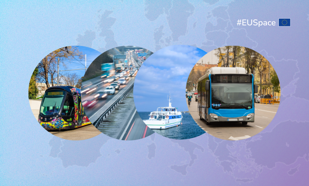
Think about it. When you have a plane to catch, you either drive or take a taxi to the airport. When you land, maybe you take a train or a bus to your destination. And from the train station to your hotel, you could walk or rent a bike from the nearby bikeshare stand.
Regardless of what mode you use to move, each mode benefits from EU Space.
Aviation
GNSS is an indispensable asset that supports all aspects of aviation, from implementing more efficient flights to enabling safer landings. Aviation also relies on Earth Observation to both monitor the weather and its environmental impact.
Maritime
Ferries use Copernicus’ near real-time data to evaluate the state of the sea, currents and temperature. Thanks to the increased accuracy, coverage and resiliency that Galileo brings, maritime transport also benefits from better prediction of vessel location, a decrease in collisions and more efficient manoeuvrings.
Rail
GNSS has become a fundamental tool for asset management, maintenance and train driving optimisation, along with a range of safety-related applications, while Earth Observation contributes to rail safety by providing information on risk related to vegetation, landslides or floods encroaching onto the railway.
Road
GNSS has long been used to support emergency services, track dangerous goods, implement road user charging schemes, reduce traffic congestion and enable autonomous functions in vehicles. Earth Observation plays a role in congestion control, along with supporting road safety and emissions monitoring.
Bikes and Scooters
Bike and scooter sharing programmes use Galileo-enabled receivers to ensure assets are evenly distributed and readily available in high-use areas. The highly accurate positioning that Galileo provides also supports users as they navigate their way from docking station to destination.
Public Transport
Public transportation systems are leveraging the precise positioning and high accuracy of Galileo to refine the positioning of trams and buses.
From multimodal to intermodal
While a typical trip today is multimodal, in the future it will be intermodal. The difference? In a multimodal journey, every segment – the trip to the airport, the flight, the train – happens in a silo, with separate ticketing, separate apps, etc. If something goes wrong in one segment, it can cause the entire trip to go off the rails.
Intermodal travel on the other hand ensures seamless integration of various transport modes, enabling passengers to travel door-to-door in an efficient, sustainable and resilient way while addressing challenges related to fragmented connectivity between operators and modes.
But an interconnected transport system is more than just a network of different transport modes working together. It’s about creating a seamless, efficient and inclusive experience for passengers, enabling personalised mobility solutions and, ultimately, helping cities meet their economic, environmental and social goals.
“Interconnection ensures that every mode works in harmony with each other, leading to a smart, sustainable and resilient transport ecosystem that meets the needs of both citizens and the environment,” says Dr. Eusebiu Catana, Head of Transport for Logistics at ERTICO.
ERTICO is a public-private partnership dedicated to developing, promoting and connecting Intelligent Transport Systems and Services (ITS) across Europe. It is also the coordinating partner of the JULIA project, which is using EU Space data and services to increase intramodality in public transport systems.
Leveraging the synergies of European GNSS and Copernicus Earth Observation
The EUSPA-supported project is integrating Galileo and EGNOS (collectively known as European GNSS, or EGNSS) into buses, trains and trams to enable the real-time tracking and precision navigation required to ensure smoother connections between different modes of transport. These same EGNSS-based solutions are being used to provide passengers with real-time updates, improving their travel experience by minimising waiting times and ensuring smoother transitions between connecting services.
“With optimised routes and efficient scheduling, users will find it easier to transfer between different modes of transport, thus improving their daily commute,” explains Dr. Catana.
The project is also leveraging the synergies of EGNSS and Copernicus to foster intermodal knowledge sharing and decision-making. For instance, it has built digital hubs that pull from both EGNSS and Copernicus data to provide unique insights to urban planners and transport operators. Likewise, its decision-support tools utilise both EGNSS and Earth Observation data to assess and prioritise transportation projects, ensuring that investments are aligned with the long-term goals of interconnectivity, efficiency and sustainability.
“By creating tools that integrate EGNSS and Copernicus, cities can build replicable systems that can be scaled across regions and create opportunities for cross-border and multi-sector partnerships,” notes Dr. Catana.
Putting it all together
The JULIA project aims to put all these features together into an innovative application that will provide end users with access to a streamlined, interconnected transport system. The envisioned app will use EGNSS to provide real-time information on the location and schedule of buses, trains, trams and ferries and, in the case of a delay or disruption, to suggest alternative routes or transport modes.
“The application will likely offer intermodal route planning, helping users plan door-to-door journeys using the most efficient combination of transport and ensuring smooth transfers between services,” says Dr. Catana.
The app will also offer a unified payment system, allowing users to pay for multiple modes of transport with a single, integrated solution. “They’ll be able to purchase tickets, passes or even pay-per-use for services such as bike-sharing or public transport rides – creating a truly seamless travel experience,” adds Dr. Catana.
The same application could use Copernicus data to offer such added-value services as air quality maps and, based on these, suggest healthier travel alternatives. Earth Observation data can also be used to promote eco-friendly transport choices like electric buses, carpooling or walking, and incentivise users to adopt greener options by offering rewards.
From trams and trains to planes and even flying taxis
While the JULIA project initially aims to cover buses, trams, trains and bicycles, its solutions are being designed to include other forms of transport, including aviation and such emerging technologies as flying taxis.
“By prioritising space-based solutions like EGNSS and Copernicus, transport authorities can ensure that the systems they implement today are able to evolve into the interconnected, smart and sustainable transport systems of the future,” concludes Dr. Catana.
The project is currently developing digital twin solutions that cities can use to further integrate and improve their public transportation services.
Media note: This feature can be republished without charge provided the European Union Agency for the Space Programme (EUSPA) is acknowledged as the source at the top or the bottom of the story. You must request permission before you use any of the photographs on the site. If you republish, we would be grateful if you could link back to the EUSPA website.