Copernicus data for U-space airspace design
Integrating unmanned aerial systems (UAS), or drones, into an already busy airspace presents a number of challenges, including safety concerns, regulatory complexities, technological limitations, and the need for new infrastructure and communication networks.
Helping to answer these challenges is U-space, Europe’s UAS Traffic Management (UTM) system.
U-space is a system of services that facilitates the safe and efficient integration of drones into the airspace. One of the most important components is Specific Operation Risk Assessment (SORA), a methodology used to classify the risk posed by a drone flight in a specific category of operations (e.g., beyond visual line of flight, visual line of flight) and for identifying mitigation and safety objectives.
While SORA takes into account numerous factors, population density is at the top of the list. “Population density is a key indicator in drone flight planning,” says EUROCONTROL UAS Specialist Marcos Moreno Solana. “It determines the level of risk and the necessary safety measures, especially in densely populated areas where the potential for incidents and damage is higher.”
Now, with the addition of Copernicus population density data, this risk assessment is even more precise and the mitigation measures more effective than ever.
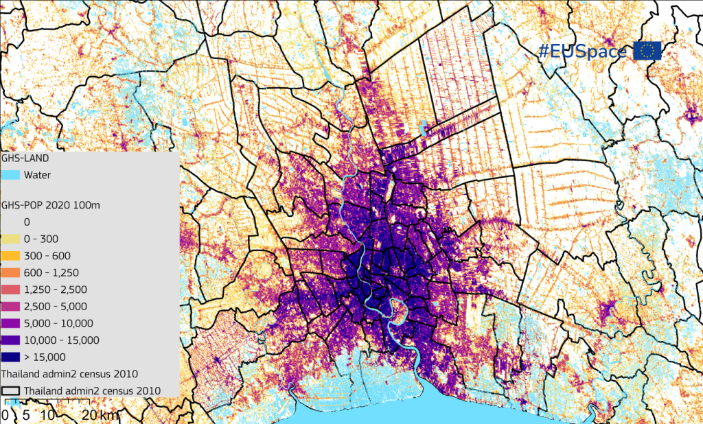
Specifically, the EUROCONTROL Innovation Hub has integrated the Copernicus Global Human Settlement Layer (GHSL) dataset into its ground risk computation tool.
Using the GHSL as a trusted data source, the tool can produce maps with a precision of up to 3 arcsec in population density distribution. Aviation authorities can use this Hub in assessments of U-space airspace design to mitigate the ground-based risks posed by some drone operations.
"The addition of Copernicus data significantly improves the efficiency of U-space airspace designation with respect to locations with minimal population and for evaluating risks and safety measures over the terrain,” adds Moreno Solana.
“We are glad Copernicus data is being fully leveraged by the EUROCONTROL Innovation Hub and can contribute to the U-space Ground Risk Computation tools and its mission of safely integrating drones into the European airspace,” concludes EUSPA Head of Market, Downstream and Innovation Fiammetta Dani.
The EUROCONTROL Innovation Hub is a leading European simulation centre offering unique and invaluable facilities and expertise to develop and validate innovative solutions to shape a safe, efficient and sustainable future for European aviation.
EUSPA and EUROCONTROL have been collaborating to bring the benefits of EU Space data and services into the European airspace since 2015.
Learn more about how space data and services can enable a harmonised drone ecosystem:
Download our EU Space for Drone Operations brochure
Media note: This feature can be republished without charge provided the European Union Agency for the Space Programme (EUSPA) is acknowledged as the source at the top or the bottom of the story. You must request permission before you use any of the photographs on the site. If you republish, we would be grateful if you could link back to the EUSPA website.